YMCA Camp Ockanickon, Medford, NJ

For Limoncello’s 9th birthday, she took a hike through Camp Ockanikon!

We are lucky enough to have a YMCA Camp Ockanickon in our “back yard.”  This 800 acres csmp is located in the heart of the South Jersey Pinelands.

This is alsp were I took Lager for first hike on March 31, 2016, where he was accompanied by his 2-legged cousin, James.

lager hike


Rita’s first hike was also at Camp Ockanickon on July 11, 2016. We took the same route as we did on Lager’s first hike!

File Jul 11, 8 30 17 AM

Historic Smithville Park, Mount Holly, NJ

The Smithville Village is listed on the National and New Jersey Registers of Historic Places. Smithville began as a small mill operation on the Rancocas Creek and grew to a major industrial plant which employing hundreds of workers from the 1860s to the 1920s. Smithville was well known for its high-quality woodworking machinery, the Smithville-Mt. Holly Bicycle Railroad, and the Star high wheeled bicycle.

2023 with Jägermeister and Our Friend Heather with Her Dog Ellie

2020 with Margarita and Porter

For Margarita’s 10th birthday, she hiked at Historic Smithville Park with brother Porter and Cousin Clyde!

2013 with Limoncello 

3.8 mile hike in Historic Smithville Park

photo 3 (5)

photo 1 (4)

photo 2 (5)

Nolde Forest State Park, Reading, PA

While camping at Eagles Peak Campground, we decided to do a local hike.

96849e0f6225d4c9f0e5437fab587122

We ended up at Nolde Forest State Park  – a gorgeous sate park with more than 665 acres of beautiful woodlands.

unnamed (3)

What a beautiful place to hike! This area was acquired by Jacob Nolde  in the early 1900s.  As the story goes, a single white pine grew in a meadow. Inspired by this tree, Jacob Nolde hired an Austrian forester to create a coniferous forest. As the trees grew, they formed a this magnificent forest!

There was a pretty stream running through most of our hike.

unnamed (2)

Cello and Hooch were excited to be on this adventure!

DSC06196

Throughout the hike, there were many unique stone bridges and lined walkways.DSC06203

DSC06213

unnamed (4)

DSC06212

This was  Hooch’s first Pennsylvania hike – and first hike in the warmer weather.  He was getting tired quickly, and began to stop in the shady areas for a breather!

unnamed (6)

At one point, in usual Hooch fashion, he decided he was “DONE!” unnamed

Belly rubs, anyone?unnamed (1)

At the end of the hike, we were rewarded with the beauty of an early 1920’s mansion.  In 1926, Hans Nolde, a son of Jacob, began work on the Tudor-style mansion that sits on the property.  Today, visitors can tour the grounds as well as the inside of this mansion.

DSC06217

DSC06219

DSC06222

The garden area of the mansion was incredible!DSC06228

DSC06238

DSC06236

DSC06232

Pennsylvania purchased the property in the late 1960s , and in 1970, Nolde Forest was established as the first environmental education center operated by the Bureau of State Parks.  Now operated by the Pennsylvania Department of Conservation and Natural Resources,  and Bureau of State Parks, the park provides a wide variety of programs for students, teachers, and adult groups. Teaching stations offer places for students to work, and benches for those who wish to sit and enjoy nature.

Double Trouble State Park, Bayville, NJ: First Hike of 2015

il_340x270.573477766_1op2

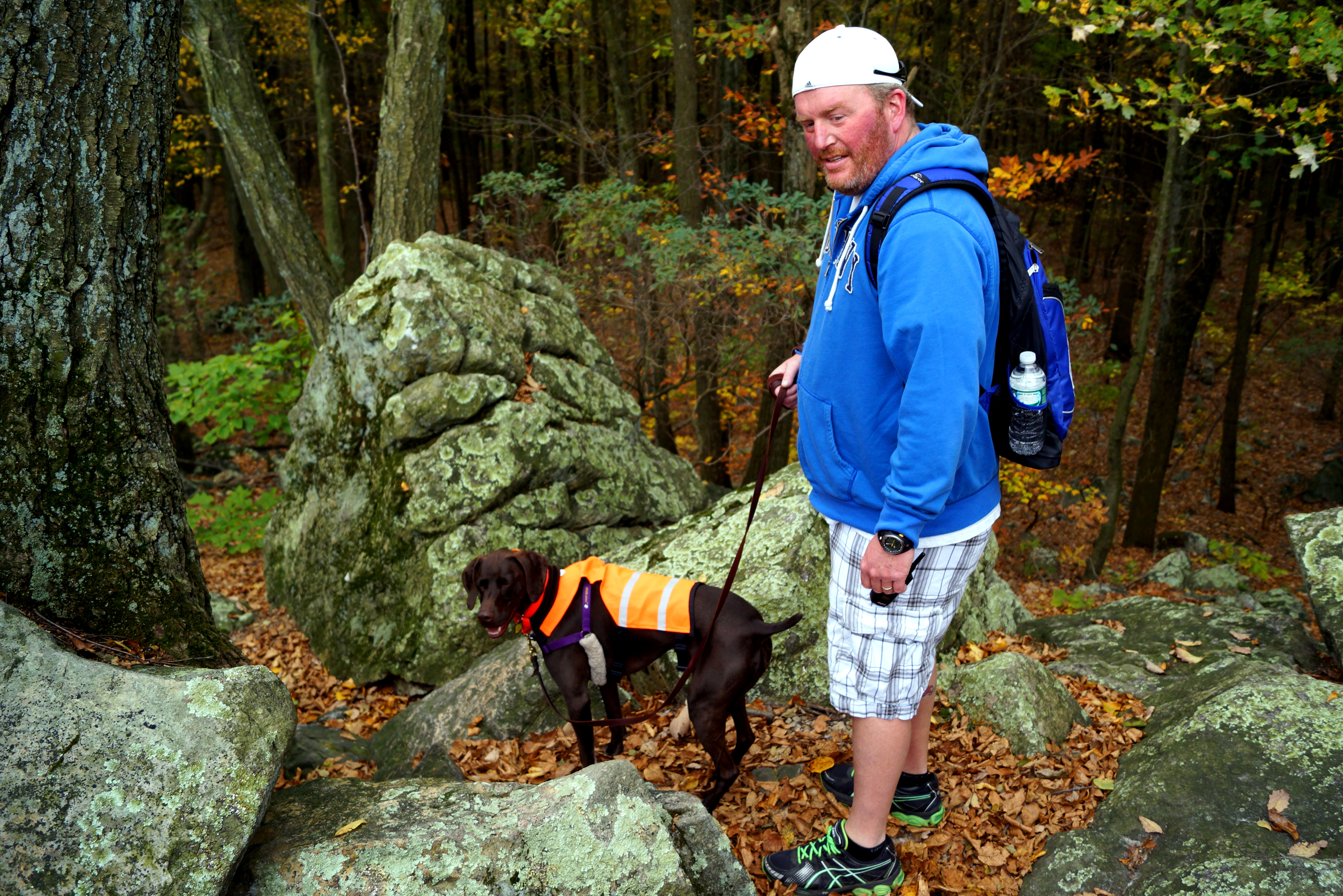
“Double Trouble,”…What an appropriately named destination for our two Hooligans’ first hike of 2015 !

There are conflicting stories about how this area got its name.  The most common legend focuses on the dam at Cedar Creek.  Sawmill operator, Thomas Potter, may have “coined” the words “Double Trouble” after heavy Spring rains washed out the dam twice in the 1770’s.

Another myth says that muskrats in the area were relentless at chewing on the dam.  When a hole was discovered from the muskrats’ constant gnawing, workmen in the village would say, “Here’s trouble,” and rush to repair the leak.  One day, two holes were discovered at once, and a village worker overheard the owner say, “Here’s Double Trouble.”

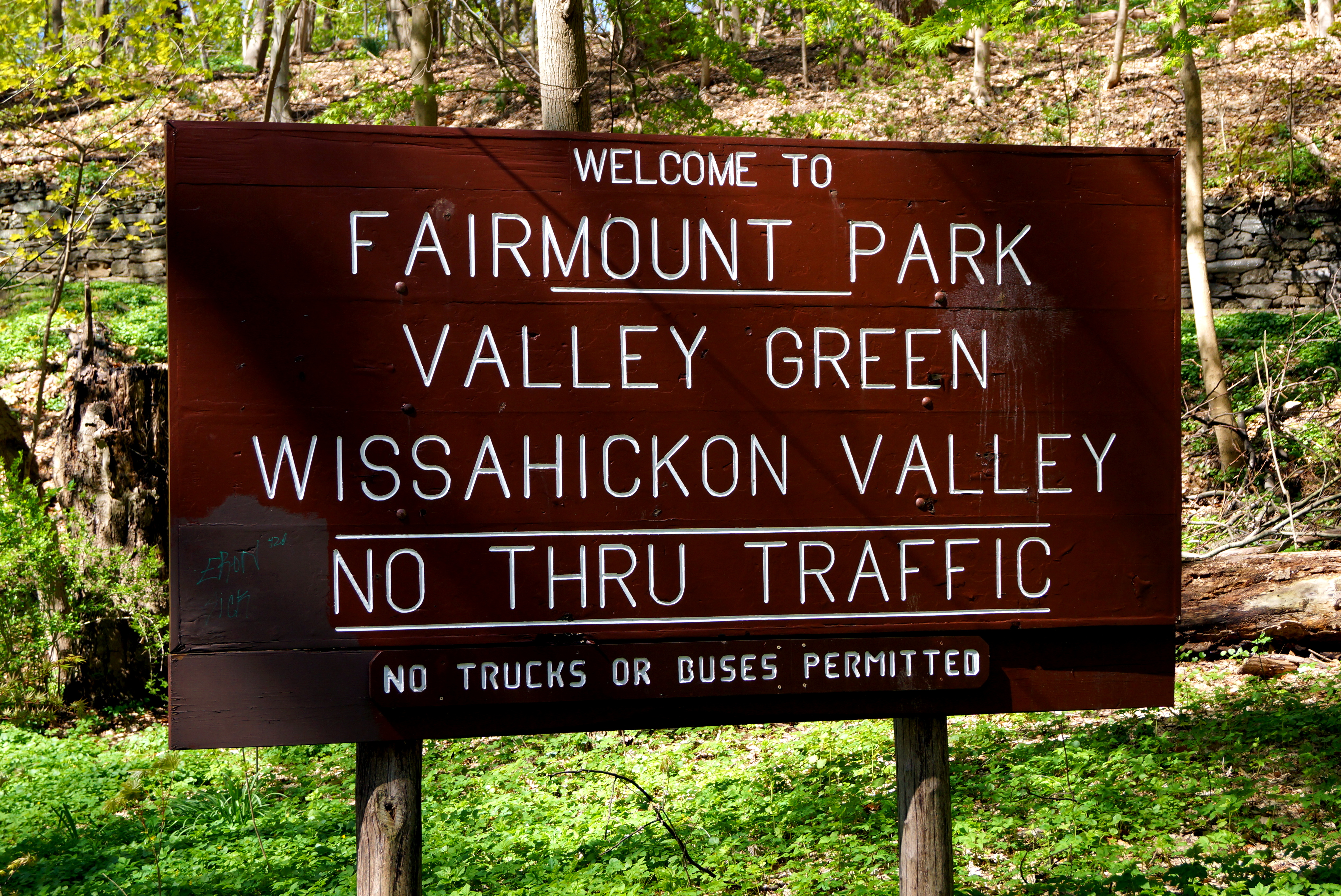
Welcome to Double Trouble State Park!

DSC02251

Located on the eastern edge of the New Jersey Pine Barrens, and encompassing over 200 acres, Double Trouble State Park provides a fine example of a typical Pine Barrens community centered around the logging industry and cranberry agriculture.  Isolated Pine Barrens communities such as this one (and Batsto)  were built to be entirely self-sufficient, and their survival depended 100% on the success of the particular industry the community was built around.  This area has a natural cedar forest, and stream, which provided both raw materials and water power for a substantial lumber industry from the 1700’s to the 1900’s.  As workers cut down the timber, the cleared cedar swamps created a bog environment – perfect for growing cranberries. Cranberry culture began at Double Trouble Village in the 1860’s. By the 20th century, the Double Trouble Company was one of the largest cranberry operations in the state.

Did you know that today, with approximately 3,600 acres of cranberry farms, New Jersey is currently the third largest cranberry producing state in the United States?  Cranberries in our parts are known as the “Jewel of the Pine Barrens!!”  Interestingly, New Jersey’s leading cranberry farmer, William S. Haines, is located in Cello and Hooch’s birth-town of Chatsworth, NJ!  Haines has over 700 acres of cranberries on his Chatsworth Pine Island Company Cranberry Farm, and his family’s history of cranberry cultivation dates back to 1895.  Cello and Hooch’s birth-town also is also home to both an Ocean Spray juice company plant (one of the leading cranberry juice companies), and one of New Jersey’s largest festivals… The Cranberry Festival, a celebration of New Jersey’s cranberry harvest, offering a tribute to the Pine Barrens and its local culture.  There is a huge, diverse presentation of local artists, craftsmen, and wineries – some offering demonstrations, and all providing items for sale.  And of course… there’s “everything cranberry,” including cranberry jam, jelly, chutney, ice cream, cranberry wine!  

Ever wonder how Cranberries are harvested?  It’s really pretty cool…First, Cranberries grow in the bed of a bog.  Cranberries have pockets of air inside them. Because of this, cranberries float in water.  When the cranberries are ready for harvesting, the bogs are flooded to dislodge the fruit from the vines. Water reels, nicknamed “egg-beaters” are used to “stir-up” the water in the bogs. When the water is stirred, the cranberries disconnect from the vine, and float to the surface of the water!  Wooden or plastic “booms” are used to round-up the berries, which are then lifted by conveyor, or pumped into a truck to be taken to a receiving station to be cleaned and processed.  Pretty neat, huh?!

Cranberrys_beim_Ernten

Cranberry cultivation still continues today in several bogs at Double Trouble State Park. Some of the bogs in the park are maintained and harvested sporadically by farmers who lease the bogs,  since the purchase of the park by the state in 1964.  Here are pictures of cranberries being harvested at Double Trouble State Park

picking-1 DT HARVEST 2

dtharvest08-10

DT HARVEST

Double Trouble State Park is also listed on Weird NJ for an unusual and explainable event that occurred here!  The pictures below captured this “weird” event.

Click HERE to read the full story!

Tunguska-3 (1)

The water in Double Trouble State Park is “tea” colored, and known as “cedar water” – just like the lake Cello and Hooch live on – and most lakes in the Pine Barren area.  This coloring is caused by the tannic acids found in the Atlantic White Cedar trees (which is what our log home is made of) — as well as the naturally occurring iron in the water.

Here is a picture of Hooch swimming in our lake this past summer.  You can see the color of the “cedar water” in our lake.

DSC05150

Double Trouble Village has a restored sawmill and cranberry sorting / packing house, both containing working operational equipment. These two buildings were the focus of the village, which also includes a late 19th century one room schoolhouse, general store, bunk house, cook house, shower house, maintenance shop, pickers’ cottages and the foreman’s house. Most buildings are not restored, and look to be left “as is” on the inside (peek inside windows of the buildings while you are here!!) and only the sawmill and cranberry packing house are restored, and open to the public, exclusively during guided tours.

Double Trouble Village was purchased by the State of New Jersey in 1964 to help protect the Cedar Creek watershed.   Double Trouble was placed on the State Register of Historic Places in 1977, and on the National Register in 1978.

Cranberry Bogs

DSC02274

DSC02271

Double Trouble School
Operated from approximately 1893-1915, this one-room school is the oldest remaining structure in the village.

If you peek in the windows, you can see the old school desks inside.

DSC02253

Burke House
This was the home of the Burke family from 1938 until 1957.

Mr. David Burke was foreman of the cranberry processing operations until 1967.

DSC02261

Cranberry Sorting and Packing House
Built in 1909, This building was filled with workers who hand-scooped cranberries, sorted them according to size and quality,

and then packed the berries to be transported to a market.

DSC02278

DSC02276

DSC02281

General Store
(circa 1920) The general store provided the early villagers with staples such as oatmeal, flour, and
sugar. From the 1930’s until it closed, convenience items like candy, cigarettes and gloves were sold here also.

DSC02266

Most buildings also had an outhouse out back:

DSC02268

Bunk House
(circa 1900) Also called the “communal house”, this is where single workers lived during the seasonal
cranberry harvest.

DSC02285

Sawmill
(circa 1906-1909) The sawmill produced lumber, shingles and other products for sale and for use in the village and cranberry operations.

DSC02291

DSC02293

Harvest Foreman’s House
(circa 1900) This was the seasonal home of the migrant workers’ foreman.

DSC02287

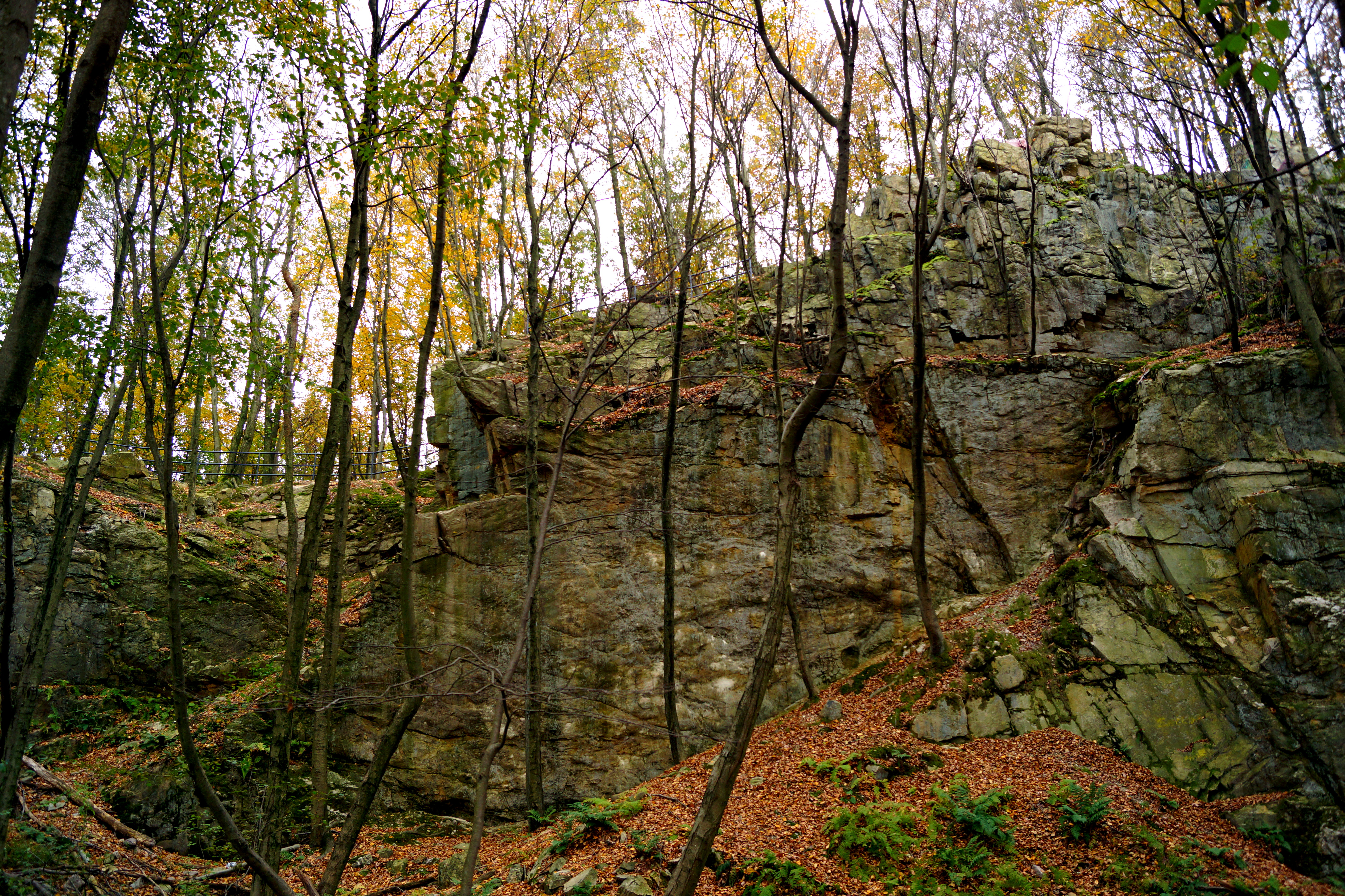
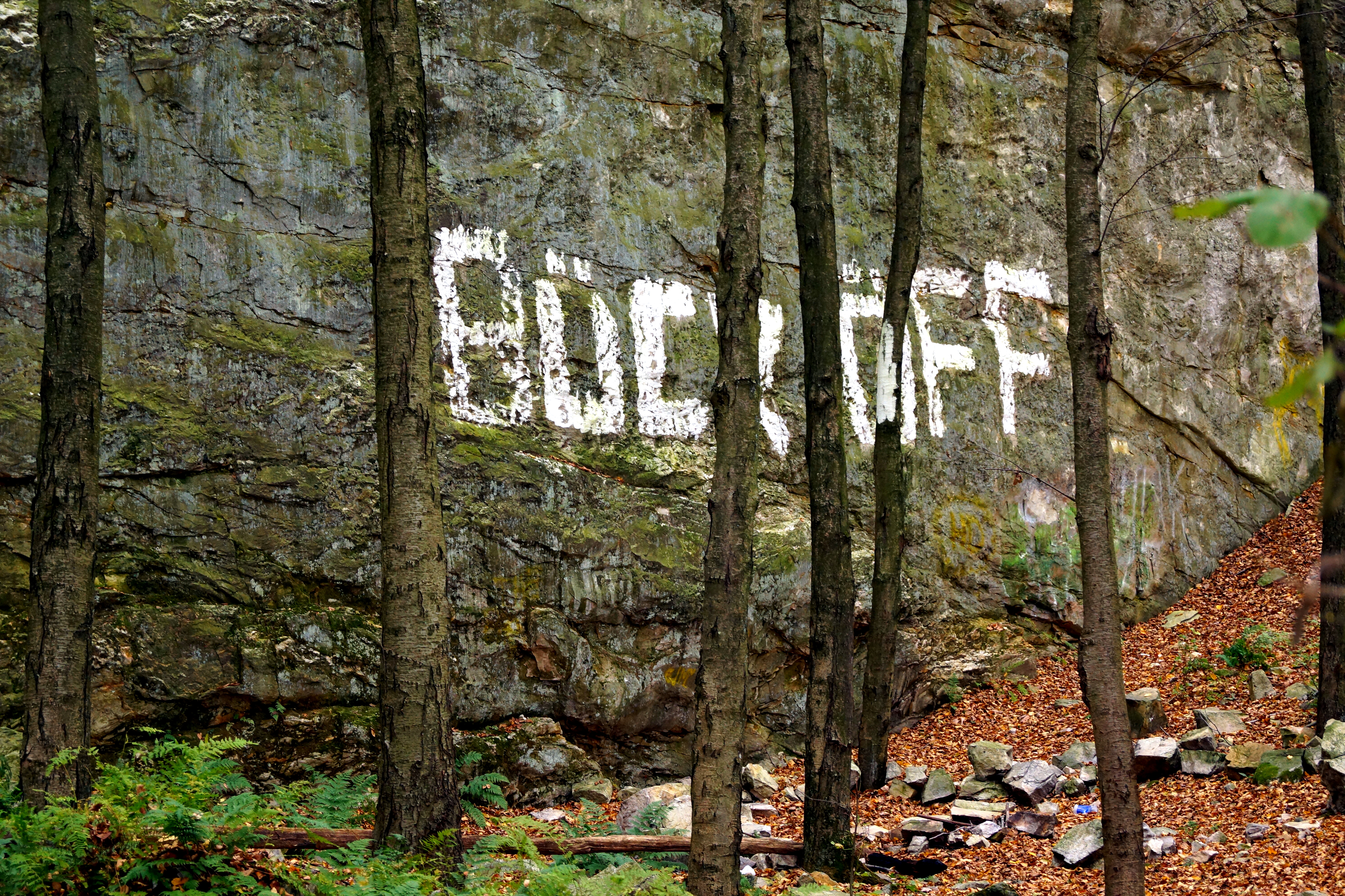
There are several different trails you can take in Double Trouble State Park.

Trail Guides are available at the trail heads, so that you have a printed map and description of the trail to carry with you.

Fullscreen capture 112015 94526 PM.bmp

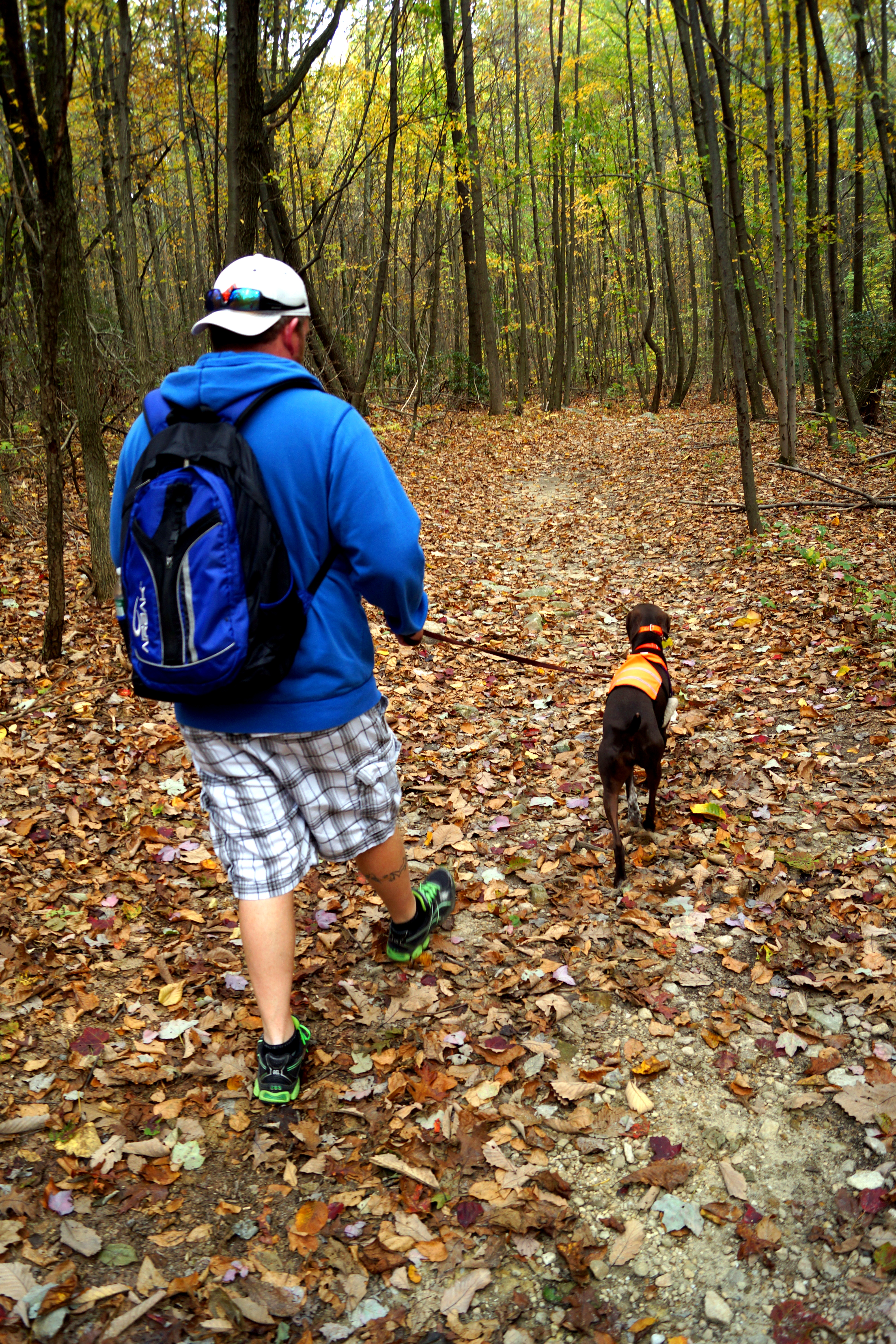
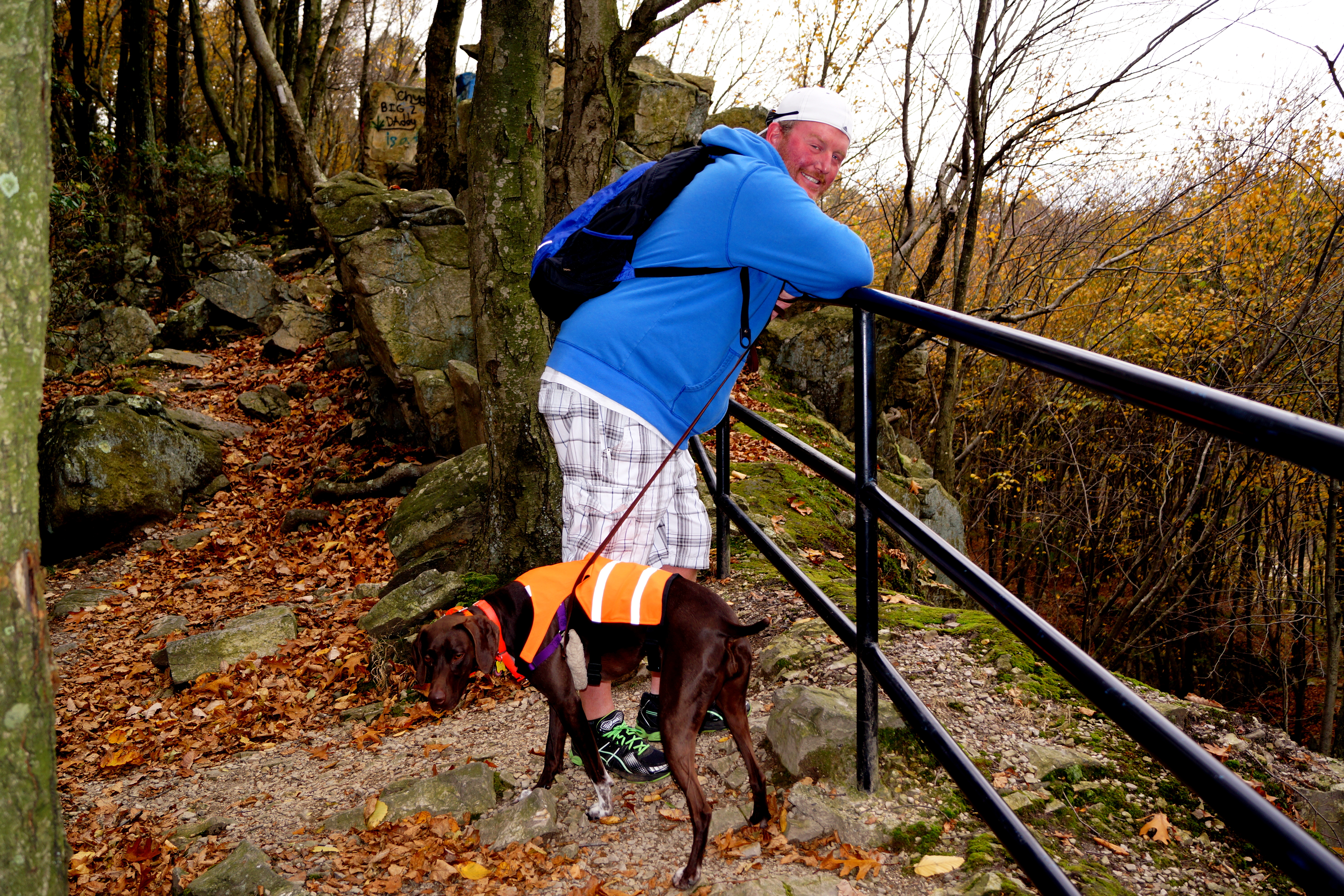
After exploring the village, we chose the Nature Trail.

unnamed

This was not the longest of trails, but considering the weather was pretty chilly, we were content with our choice.

unnamed (3)

The Nature Trail passes along a couple of cranberry bogs, crosses over Cedar Creek, and passes through a cedar forest, as well as a peat bog.

DSC02314

This is a part of the trail that runs in between two bogs:DSC02299

unnamed (1)

Parts of the park are open for hunting, so be sure to check with the park office, and/or NJ’s Division of Fish and Wildlife to educate yourself on any hunting activity before you begin your adventure.  In addition to hiking, visitors can canoe or kayak their way through the park, using several access points on Cedar Creek.   There are also public bathrooms and an Information Center conveniently located in the Pickers’ Cottage (circa 1940), just beyond the parking lot.   Pickers’ cottages in the village housed seasonal workers – including family groups. Every year 30-40 migrant workers arrived on Labor Day weekend, and lived in the cottages until Thanksgiving. These village employees worked solely in the bogs, hand-picking the cranberries.

As you can see, we all very much enjoyed the abundant history and unique sights of Cello and Hooch’s first hike of 2015.

What will be YOUR first hike of the year?  Cello and Hooch would love to know…go on, now… TAKE A HIKE!

Blog-Take-A-Hike

It’s the Friday Pet Parade!  Don’t hesitate to join in the Pet Parade, and share your favorite post with others.  Visit one (or all!) of the hosts below, and link up to the parade!

 Rascal and RoccoBasil the Bionic Cat BlogLove is being owned by a Husky, Barking From the Bayou, and Jan’s Funny Farm.

Hooch’s First Hike: Historic Batsto Village, Hammonton, NJ

We took Cello and Hooch to historic Batsto Village for a hike!

entrance_sign

Although this is both Cello and Hooch’s first visit to Batsto Village, this historic site holds a very special place in our hearts.  If you’ve been following this blog, you know the story of how we discovered the German Shorthaired Pointer, and why we knew we would eventually forever have GSPs as family members.  If you don’t know the story, click HERE .  Six months after we bought our dream home, Brian and I went to the Country Living Fair, an event held annually on the third Sunday in October at Batsto Village, in hopes to find some historic items related to our area to decorate our home.  While walking through the Village, we saw (for the very first time) a couple with a German Shorthaired Pointer.  We approached the couple to pet the dog, and to ask some questions about the breed, since at the time we knew nothing about GSPs, other than what we had researched online.  When Brian asked what the man thought of the breed, the man’s exact words were, “These dogs are the biggest pain in the A_ _.”

I often think of this, with three things that come to mind:

1) I can only feel sorry for that man who didn’t understand just how wonderful GSPs are

2) I pray that the man was joking, and that the beautiful dog we saw that day is leading a family-life full of love and care

3) I thank God we didn’t let the man’s opinionated statement divert us from our desire to have GSPs in our family.

At this exact spot, approximately 5 years ago, we saw and petted a German Shorthaired Pointer for the very first time!  Today, Brian and Cello stood in that same spot:

DSC02222

Batsto Village dates back to 1776, and is located in Southern New Jersey in the Wharton State Forrest, New Jersey’s largest state forest, located in the heart of the Pinelands (home of New Jersey’s cultural icon, The Jersey Devil!)   Archeologists have found evidence of Prehistoric life in the Batsto area as well…the history dates back several thousand years!

Batsto Iron Works was built along the Batsto River in 1766. Batsto had all the natural resources necessary for making iron:  bog ore from the banks of the streams and rivers, wood for fuel, and water for power. The Batsto Iron Works produced household items such as cooking pots and kettles. During the Revolutionary War, Batsto also manufactured supplies for the Continental Army. By the mid 1800’s, iron production was down, and Batsto re-invented itself as a glass-making community, specializing in window glass.

Today Batsto Village is a New Jersey Historic site, and is also listed on the New Jersey and National Registers of Historic Places.

The Batsto area also has numerous hiking trails, some of which connect with the 50-mile long Batona Trail (whose name derives from the words BAck TO NAture).

unnamed

We decided on the orange-blazed Tom’s Pond Trail.

unnamed (1)

To get to this trail, park in the Visitor Center parking lot.  Walk past the Visitor Center, toward the Village and turn right to go past the Mansion, a 32-room home that served as the former residence of generations of ironmasters.  Fourteen rooms, (including the parlors, dining room, library and bedrooms), are open to view for people visiting Batsto.

DSC02206

Just beyond the Mansion are many original structures still standing in the Village, including a General Store, Post Office, Gristmill, Sawmill, Blacksmith, Glassworks, Ice House, and the Batsto Church.  Other cool things not to pass by are the remains of an ore boat, extracted from the bottom of Batsto Lake, an ore pile, iron furnace, and Farm.

The Gristmill below was powered by Batsto Lake and processed the wheat, corn, other grains sold in the Village’s General Store:

DSC02213

The picture below is the Piggery.  This structure was used to slaughter hogs to provide food for the Village. The tall stone and brick tower on the left provided water from a large tank, which flowed into a large processing tub where the animal parts were further processed. The cast iron tub is thought to have been manufactured by the iron workers in the village.

DSC02209

Other Farm structures to check out before continuing on the hike are:

Wood House: where wood for the Mansion’s cook stoves was stored here

Carriage House: used to house various horse drawn vehicles

Horse Stable: ten stalls, where riding horses and carriage horses were kept

Threshing Barn: contained a threshing machine which separated the grain from the straw and chaff

Range Barn: where the cattle were kept

Mule Barn: constructed of Jersey ironstone, it served as a team stable, hay storeroom, and an 8-stall mule barn

Continue across Batsto Lake on a plank bridge, where you will also see (and hear!) the dam.  Just across the dam is the Sawmill, which was powered by  Batsto Lake.  The mill cut lumber and shingles that were transported by train all over the east coast, providing additional profit for Batsto.

DSC02246

Just over the bridge is a great place to sit and take in the views of Batsto Lake.  Batsto Lake and River were the major reasons for the location of the Village and its Iron Furnace. The river provided bog ore, and the lake was produced by the dam which allowed boats to move the bog ore from the river to the Iron Furnace.

unnamed (4)

The lake also provided water power for both the Sawmill and the Gristmill.

DSC02215

The sandy trail then leads through  a row of homes once inhabited by the employees of Batsto.

DSC02225

The state of New Jersey purchased the Batsto area in the mid 1950’s. At this time, there were still a few people living in the Village houses, and they were told that they were allowed to remain living there for as long as they wanted.  It wasn’t until 1989 that the last house was vacated!

DSC02231

People emplyed at Batsto lived in cottages consisting of 2- 3 rooms downstairs, and 2-3 rooms upstairs.  Each house had an attic, fireplace, and an outhouse.

DSC02232

Several homes are open for visitors to walk through.

DSC02227

unnamed (2)

Once past the cottage-style homes, a path leading to the orange-blazed Tom’s Pond Trail and the yellow-blazed Mullica River Trail is set diagonally off to the right.

DSC02240

You can pick up the yellow-blazed Mullica River Trail along the way, but we decided to stick with just the orange-blazed Tom’s Pond Trail.

Although there were many Pine and Oak trees, we also went through a White Cedar bog, located along the Mullica River. Here is a picture of Hooch and Jenny just before we went through the bog:

unnamed (1)

There were several foot bridges we crossed along the way.

DSC02244

Hooch did a great job keeping up!unnamed (6)

The orange-blazed trail is very well marked.  The path follows along the Sleeper Branch of the Mullica River, then loops around for your return trip to the starting point. unnamed (5)

Not bad for Hooch’s first hike!

In addition to the historic buildings and hiking paths, Batsto hosts many events and tours.  Camping and Canoeing are also popular at this historic site.  Other amenities include a park office, restrooms, telephone, water, and picnic area.

Wissahickon Valley Park, PA

DSC00701Wissahickon Valley Park is located in Pennsylvania, in the Fairmount Park area of Philadelphia.  The park consists of 1,800 acres and consists of 50 miles of trails, used by hikers, runners, equestrians, and cyclists.  The Wissahickon Creek, which runs through the park, is stocked each year with trout, which draws many fisherman as well.

I picked this hike for us to do on my birthday, as I have had this hike on my All Trails “wish-list” for quite some time.

It just so happened that my birthday also fell on Wissahickon Day,  where each year on the last Sunday in April people gather at the park to celebrate the fact that Forbidden Drive ( a gravel road that runs along the Wissahickon Creek) was successfully closed to cars in 1921.  Around that time, a turnpike was proposed to run the length of this gravel road.  However, equestrian park users protested with a parade of carriages and horses.  Hundreds of horses turned out for the parade in protest of the turnpike, and the proposal was defeated.  Each year on Wissahickon Day, horses and carriages return to celebrate…festivities include a horse show, parade of carriages and horses, and added this year was a Fancy Hat Competition.

DSC00720


We chose to skip the horse-related activities, as Cello has become “spooked” by horses lately (something we are trying to work on with her). We did see lots of horses and carriages coming and going from their activities though!

DSC00798

DSC00801

DSC00795


We did about a 3.37 hike that led us on the trails, as well as onto Forbidden Drive.  The hike took longer than usual because of all the stops we made to take pictures, and also because Cello has suddenly begun to lunge at all bikes, as well as all horses, and random bigger dogs.  She was a bit on-edge at the park with all the  horses, so we didn’t want to push-it with her. We have contacted a well-recommended local trainer and hope to counter-condition these behaviors.

Here is the hike that we did, recorded on MapMyFitness:

hike pic 2


 Our hike began on Forbidden Drive at the Valley Green Inn, a historic Inn along Forbidden Drive.

DSC00719


About a half-mile into our hike we came to Magarge Dam that once powered the Margarge Mill wheel, the last active mill in the Wissahickon Valley, which closed in 1883.

DSC00809

DSC00811


At about 1.15 miles, we came across this neat stone bridge, archway, and stairs.

DSC00728

DSC00729

DSC00733

DSC00743


We stopped for a minute so that Cello could go in the Wissahickon Creek

DSC00759


Then at about 1.55 miles we reached Thomas Mill Covered Bridge, the only covered bridge still standing within the city limits of Philadelphia, and the only covered bridge in a U.S. City.  The bridge spans across the Wissahickon Creek.  As of 1980, the bridge is listed on the National Register of Historic Places.  Thomas Mill Covered Bridge was originally built in 1855.  It was renovated by the Works Progress Administration in 1938, and by the city of Philadelphia in 2000.  The bridge is open to pedestrian traffic only.

DSC00786

DSC00784

DSC00783

DSC00777


Our first time walking through a covered bridge!  

DSC00779

At this point, we decided to head back to Valley Green Inn, where we parked. We took Forbidden Drive all the way back to our starting point.

Forbidden Drive:

DSC00807

Cello and Brian on Forbidden Drive:DSC00792

Overall, this is is a great hike with decent trails, historical significance, and beautiful sights along the way!